
Table of Contents
Faroe Islands: Europe’s Last Untouched Frontier
Where grass-roofed villages, sea-cliff highways, and 18 islands of raw North Atlantic wilderness remain almost entirely off the tourist map
Eighteen Islands, One Secret Europe Almost Kept
Somewhere between Iceland and Norway, scattered across a churning stretch of the North Atlantic, sits a self-governing nation of eighteen volcanic islands that most of Europe still cannot find on a map. The Faroe Islands are not a rumor and not a metaphor for remoteness — they are a real, reachable, astonishingly beautiful archipelago that has spent the last thousand years quietly building one of the most intact natural and cultural landscapes left on the continent. No billboards interrupt the fjords. No high-rises compete with the cliffs. The tallest structure in most villages is still the church spire, and the loudest sound most mornings is wind moving through wet grass.
That is not an accident of underdevelopment. It is the result of geography so uncooperative that mass tourism simply never found a foothold, paired with a population so small and so protective of its land that it has, in recent years, begun actively limiting visitor numbers rather than chasing them. Roughly fifty-four thousand people live across these islands, spread thin enough that entire valleys belong more to sheep and seabirds than to anyone else. The Faroe Islands are what happens when a place is beautiful enough to attract the world and stubborn enough to say not all of it, not all at once.
For travelers exhausted by overtourism — by queues at Icelandic waterfalls, cruise-ship crowds in Santorini’s alleyways, or the theme-park version of ‘authentic’ culture sold in a dozen European capitals — the Faroe Islands offer something increasingly rare: a landscape that has not yet been optimized for a camera. It rewards patience, sturdy boots, and a willingness to let the weather dictate the itinerary rather than the other way around.

“There are more sheep than people in the Faroe Islands — and the sheep have better right of way.”
Geography Written in Basalt and Wind
The Faroe Islands were born from volcanic eruptions roughly sixty million years ago, the same tectonic upheaval that shaped much of the North Atlantic ridge. What emerged is a landscape of sharp basalt cliffs, deep fjords, and rolling green plateaus that look almost sculpted — stepped layers of ancient lava flow visible in the cliff faces like the rings of a tree. Streymoy, Eysturoy, Vagar, Suduroy, and the smaller islands beyond them are connected by an improbable network of undersea tunnels, ferries, and a single-lane suspension bridge locals only half-jokingly call the only bridge across the Atlantic Ocean, since it links two tectonic plates.
There is almost no flat ground anywhere in the country. Villages cling to fjord mouths where a stream meets the sea, because that is the only level land available. Roads climb switchback grades through fog banks so thick that headlights become a formality rather than a help. And everywhere, cliffs drop straight into the ocean — some of the highest sea cliffs in the world, reaching heights that make the surrounding waves look like ripples from a distance.
Vegetation is sparse but vivid. Trees are almost entirely absent, victims of relentless Atlantic wind, which means the islands present a landscape of pure grass, rock, and water, uninterrupted by forest canopy. That openness is part of what makes the scenery feel so vast — nothing blocks the eye from the horizon, and nothing softens the drama of the topography. It is a landscape best described the way locals describe it themselves: not gentle, but generous.
Torshavn: The World’s Smallest Capital With the Loudest Personality
Torshavn, the Faroese capital, houses roughly a fifth of the country’s entire population and remains, by most measures, one of the smallest and most walkable capital cities on earth. Its old town, Tinganes, is built directly into the harbor, its turf-roofed wooden buildings — painted in deep red ochre — dating back centuries and still functioning today as government offices. It may be the oldest continuously used parliamentary meeting site in the world, tracing its roots to a Viking-era assembly that predates most of Europe’s modern institutions.
Despite its size, Torshavn punches well above its weight in food, design, and music. A wave of ambitious young chefs has turned the city into an unlikely culinary destination, drawing on hyper-local ingredients — wind-dried lamb, langoustine, foraged herbs, seaweed, and fermented fish prepared using techniques refined over centuries of subsistence living in a place with almost no arable land. Restaurants here have earned international recognition not by importing trends but by leaning hard into what the islands actually produce.
Walk fifteen minutes in any direction from the harbor and the city dissolves into hillside and coastline. That compression — genuine urban culture giving way almost instantly to raw wilderness — is one of the defining sensations of visiting the Faroe Islands. There is no suburb, no sprawl, no long transition zone. The city simply ends, and the wild begins.
Villages That Feel Like Postcards Nobody Mailed Yet
Beyond the capital, the Faroe Islands are dotted with small villages that have become, almost by accident, some of the most photographed places in the North Atlantic — not because they were designed for photographs, but because they were designed for survival, and survival here produced a strange, striking beauty.
Gasadalur, on the island of Vagar, was cut off from the rest of the country by a mountain range until a tunnel was finally completed in 2004; before that, residents reached the outside world on foot over a steep pass, or not at all in bad weather. Today it is known for one of the most photographed waterfalls in Europe, a cascade dropping directly off a cliff edge into the ocean beside a cluster of turf-roofed homes. Saksun, tucked into a natural amphitheater of green hills, sits beside a tidal lagoon that was once a harbor before a storm sealed it with sand. Bour, Tjornuvik, and Funningur each offer their own version of the same formula: a handful of grass-roofed houses, a black-sand or pebble beach, and cliffs rising directly behind the rooftops.
What distinguishes these villages from curated tourist towns elsewhere in Europe is that they are still, unmistakably, working communities. Sheep graze on the same slopes tourists photograph. Fishing boats still leave from the same harbors. Grass roofs are not a heritage installation; they are simply the most effective insulation available in a climate this harsh, a building technique passed down through Norse settlement patterns that has never gone out of practical use.
“This is a place where the map still has blank spaces, and the locals would like to keep it that way.”
A Landscape Ruled by Sheep, Not Schedules
The Faroese flag, currency, and self-image are all bound up with a single animal: the sheep. There are more sheep in the Faroe Islands than people, and they are treated less like livestock and more like co-residents with unquestioned right of way. Flocks wander freely across hillsides, roads, and even village centers, marked with colored paint by owners who track them across largely unfenced terrain using methods that have barely changed in generations.
The name Faroe itself is widely believed to derive from an Old Norse phrase meaning sheep islands, and the animal’s presence shapes daily life in ways visitors notice immediately — traffic stopping for a slow-moving flock, hiking trails threading between grazing groups, wool socks and sweaters sold in nearly every village shop. Sheep farming here is not nostalgic; it remains a genuine economic backbone, alongside fishing and aquaculture, in a country with almost no other land suitable for large-scale agriculture.
For visitors used to wildlife being fenced, managed, or viewed from a safe observation distance, the sheer casualness of sharing a hiking trail with an unbothered ram is disarming. It reinforces one of the islands’ core truths: this is not a landscape maintained for visitors. It is a working landscape that visitors are, politely, being allowed to walk through.
Hiking to the Edge of the Known World
If the Faroe Islands have a signature activity, it is hiking toward a cliff edge with no railing, no crowd, and no clear sense of where the land actually ends. Trails here are largely unmarked or lightly marked, following centuries-old shepherd paths rather than engineered tourist routes, which means preparation matters more than it does almost anywhere else in Western Europe.
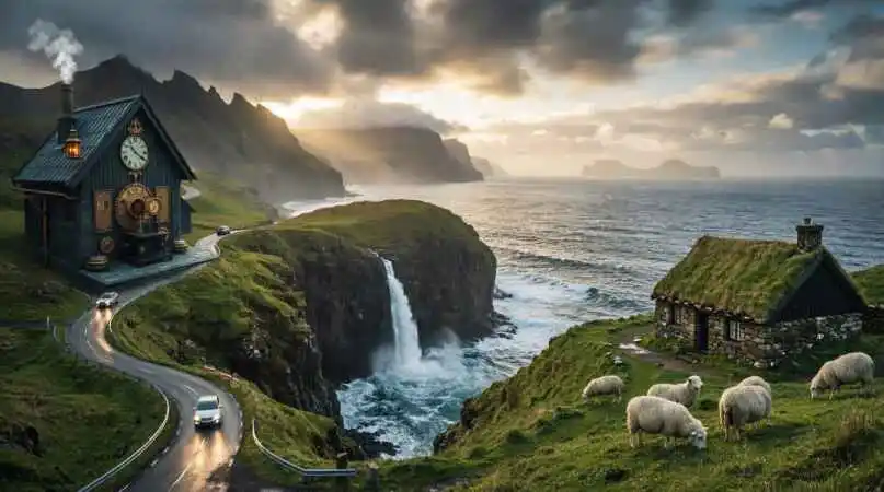
The hike to Trælanípa, a cliff above Lake Sorvagsvatn that appears from certain angles to hover above the ocean far below, has become one of the country’s most iconic walks — a reminder that some of the most striking optical illusions in nature require nothing more than the right elevation and a lake that happens to sit above sea level. On the island of Vagar, the walk to Mulafossur waterfall frames one of the most photographed scenes in the North Atlantic: a cascade falling directly into crashing surf beside a lone turf-roofed farmhouse, the whole tableau often wrapped in shifting fog.
More ambitious hikers head to Slættaratindur, the highest point in the country, or attempt the demanding route to Enniberg, among the tallest sea cliffs on earth. Regardless of difficulty, nearly every trail shares the same defining condition: weather that can shift from clear visibility to zero-visibility fog in the time it takes to eat lunch. Locals do not treat this as an inconvenience; they treat it as the baseline operating condition of living somewhere this far north and this exposed to open ocean.
The Weather Does Not Forecast, It Negotiates
No honest account of the Faroe Islands can skip the weather, because the weather is, in a very real sense, a co-author of the experience. Sitting directly in the path of the North Atlantic jet stream, the islands experience conditions that can change dramatically within hours — sun, wind, rain, and fog cycling through in a single afternoon, sometimes visible simultaneously across different valleys from a single vantage point.
This unpredictability has shaped Faroese culture as much as it shapes Faroese travel planning. Locals speak of the weather less as an obstacle and more as a mood to be read and respected, and visitors are strongly encouraged to build slack into any itinerary rather than fixed daily plans. Ferry and helicopter services to outer islands are frequently weather-dependent, and travelers chasing a specific sunset or hiking window are advised to hold plans loosely and let conditions guide the day.
There is a kind of humility this instills that few other European destinations manage to produce. In a Faroese fog bank, an entire cliffside waterfall can simply disappear from view, then reappear twenty minutes later transformed by shifting light. It is a landscape that refuses to be fully mastered, and that refusal is, for a great many visitors, the entire point of coming.
“The weather here does not forecast; it negotiates.”
Puffins, Whales, and a Coastline Built for Wildlife
The Faroe Islands sit along major North Atlantic seabird migration routes, and between roughly May and August the cliffs host colonies of Atlantic puffins alongside guillemots, fulmars, gannets, and kittiwakes, many nesting on ledges accessible only by boat or a careful cliffside approach. The island of Mykines, the westernmost point in the country, is considered one of the best puffin-viewing locations in Europe, with colonies numbering in the tens of thousands during peak nesting season.
Offshore, the surrounding waters support a range of marine mammals, including pilot whales, harbor porpoises, and, seasonally, larger cetacean species passing through North Atlantic migration corridors. Boat tours out of Torshavn and Vestmanna focus heavily on the sea-cliff ecosystems, weaving between narrow sea stacks and grottoes carved by centuries of wave action, often accompanied by circling seabird colonies overhead.
This concentration of marine and coastal wildlife exists largely because human development pressure on the coastline has remained so low. There is no large-scale coastal construction competing for cliff-nesting habitat, no significant light pollution disrupting nocturnal seabird behavior, and no industrial fishing fleet large enough to meaningfully disrupt the food chains that sustain these colonies. Wildlife here is not managed into a sanctuary; the entire country functions, in effect, as one.
A Culture Built on Isolation, Not Erased by It
Settled by Norse seafarers around the ninth century, the Faroe Islands developed a language, Faroese, closely related to Old Norse and Icelandic, spoken by a population small enough that its survival has required deliberate, ongoing cultural effort. Faroese remains the primary language of daily life, education, and media, a notable outcome in a country this small and this globally connected.
Traditional practices persist not as museum exhibits but as living parts of the culture. The Faroese chain dance, accompanied by long narrative ballads recounting Norse sagas and historical events, is still performed at community gatherings rather than staged solely for visitors. Knitting, particularly the intricate patterns used in traditional Faroese sweaters, remains widely practiced, its designs varying subtly from village to village in ways locals can still read like a signature.
Food traditions reflect centuries of adapting to an environment with almost no arable land: wind-dried mutton called skerpikjøt, fermented fish, and dishes built around whatever the sea and the hillside actually provide. In recent years, a new generation of Faroese chefs has begun reinterpreting these traditions for contemporary dining rooms, drawing international food writers to a country that, a decade ago, had almost no dining scene to speak of at all.
Getting There, and Why That Difficulty Is the Point
Reaching the Faroe Islands typically means flying into Vagar Airport, the country’s only airport, via a limited number of direct routes from cities including Copenhagen, Reykjavik, and a handful of other European hubs, or arriving by ferry from Denmark on a multi-day North Sea crossing. There is no budget-airline flood of daily flights, no cruise-ship terminal built to process thousands of passengers a day, and that logistical friction has functioned, whether by design or by circumstance, as one of the islands’ most effective conservation tools.
Once on the ground, the road and tunnel network — including several striking undersea tunnels connecting the main islands — makes internal travel more efficient than the rugged terrain would suggest, though single-lane roads, sudden fog, and sheep crossings mean driving here rewards caution over speed. Public buses and ferries connect most inhabited islands, while smaller outer islands often require chartered boats or, in some cases, are accessible only by helicopter, a public transport option unique enough that visitors frequently plan entire itineraries around securing a seat.
The Faroese government has leaned into this natural scarcity rather than fighting it, periodically running maintenance closures that invite volunteer tourists to help maintain trails and infrastructure in exchange for guided access to sites otherwise closed to the public. It is a rare example of a destination treating limited access not as a marketing gimmick, but as a genuine tool for protecting a landscape it clearly does not intend to sacrifice for volume.
Practical Notes for Traveling Lightly
Visiting well here means adjusting expectations most European trip-planning habits do not prepare travelers for. Accommodation is limited and heavily concentrated around Torshavn, Vagar, and a scattering of guesthouses in outer villages, so booking well ahead during the short May-to-September high season is less a suggestion than a practical necessity. Self-catering cottages and small family-run guesthouses tend to offer a far more grounded sense of the country than hotel chains, of which there are very few to begin with.
Packing for the Faroe Islands means packing for four seasons in a single afternoon regardless of the calendar month: waterproof, windproof layers, sturdy waterproof boots, and a willingness to hike in conditions that would cancel most outdoor plans elsewhere. Distances between villages look short on a map but often take far longer than expected once single-lane roads, tunnels, and fog-slowed driving are factored in, so building extra time into any day trip is essential rather than optional.
Respecting private land is also central to visiting responsibly. Much of the most striking scenery, including several of the country’s best-known hiking routes, crosses privately owned sheep pastures, and a number of trails require a small landowner access fee, paid directly to the farming families who maintain the paths and fences. This is not a tourist tax in the conventional sense; it is closer to a direct transfer to the people whose land actually makes the hike possible, and most visitors find the system remarkably fair once they understand it.
Photography, understandably, draws many travelers here in the first place, but the Faroese have grown increasingly vocal about a specific frustration: visitors trampling fragile turf, blocking narrow roads for a shot, or flying drones over nesting seabird colonies during breeding season. Staying on marked paths, giving grazing sheep and nesting birds a wide berth, and treating each village less like a backdrop and more like someone’s home go a long way toward keeping the islands’ hard-won balance between visibility and preservation intact.
Why the Faroe Islands Matter Now
Europe has very few genuinely undeveloped coastlines left, and fewer still that remain economically and culturally intact rather than simply poor or forgotten. The Faroe Islands are neither. They are a functioning, modern, prosperous Nordic society that has simply chosen, repeatedly, to prioritize the integrity of its landscape and culture over the short-term gains of unmanaged tourism growth.
That choice offers a useful counterexample at a moment when overtourism has become one of the defining tensions in global travel — a case study in what a small nation with real leverage over its own land can accomplish when it treats visitor numbers as something to be managed rather than maximized. Whether that balance holds as global interest in the islands continues to grow remains an open question, but for now, the Faroe Islands remain something increasingly rare on the European map: a place still mostly shaped by its residents rather than its visitors.
For travelers willing to trade guaranteed sunshine for genuine unpredictability, and curated Instagram spots for landscapes that simply exist whether anyone is watching or not, the Faroe Islands offer one of the last chances in Europe to feel, however briefly, like the map still has something left to discover.
Disclaimer: The content on this blog is for informational purposes only. The author’s opinions are personal and not endorsed. Efforts are made to provide accurate information, but completeness, accuracy, or reliability are not guaranteed. The author is not liable for any loss or damage resulting from the use of this blog. It is recommended to use the information on this blog at your own discretion.
